- The Cottonwood Fire destroyed Eagle Point Resort in Utah's Tushar Mountains.
- The fire, ignited Monday, consumed 59,613 acres by Wednesday and remains uncontained.
- Mandatory evacuations are in effect; weather forecasts may complicate firefighting efforts.
BEAVER — The Cottonwood Fire destroyed structures at the Eagle Point Resort, according to footage from a neighbor of the resort obtained by KSL, after a day of swift growth.
The fire, which ignited Monday evening, consumed thousands of acres by Wednesday morning, reaching 59,613 acres. It remained 0% contained at that time, according to the U.S. Forest Service. The cause was still under investigation.
Eagle Point Resort is a ski resort in the Tushar Mountains, which, according to its website, was established in the 1970s.
Ski Utah is "heartbroken by the situation facing Eagle Point Resort," said Nathan Rafferty, president of the organization, in a statement to KSL.
"An independent mountain and genuine community pillar, Eagle Point is a source of recreation, livelihoods and local identity for the region it calls home. The impact of this fire will be felt across Beaver County and throughout the Utah ski industry," Rafferty continued. "Our gratitude goes to the firefighters, first responders and volunteers who have worked under extraordinarily difficult conditions to protect lives and structures in the area."
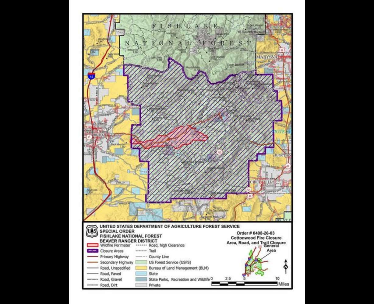
Mandatory evacuations remained in place for Eagle Point, Merchant Valley, HiLo Estates, Arrowhead Summer Homes and surrounding areas.
Early Wednesday, the Piute County Sheriff's Office said in a social media post that Junction and Circleville were in ready status and should prepare to leave the area if necessary. State Route 153 was also closed in both directions.
Utah's surging acreage loss
The Cottonwood Fire is a major contributor to Utah's rising fire activity, which has surged in late June and expanded at least eight times that of last week's acreage lost.
More than 105,000 acres have now burned across Utah this year, per data released by state and federal firefighters. That was before the Cottonwood Fire nearly doubled in size, but the number jumped past the 100,000-acre mark on Tuesday, as compared to 13,300 acres burned by June 17.
The total is already the second-largest acreage burned since 2021, following last year's nearly 165,000 acres. At least three-quarters of all of this year's fires have been human-caused, including at least two of the state's three biggest fires so far this year, according to Kayli Guild, fire prevention and communications coordinator for the Utah Division of Forestry, Fire and State Lands.
"These numbers highlight the important reality: Many wildfires can be prevented," she said, in an update on the state's wildfire situation on Wednesday, adding that dry vegetation and strong winds this week have fueled much of the new fire growth.
Forecast could complicate firefighting efforts
The forecast for the rest of the week may not help, either.
A high-pressure system near the Texas Panhandle and a low-pressure system off the California coast are helping push scattered storms into Utah on Wednesday and Thursday, said KSL meteorologist Matt Johnson. The quasi-monsoonal system could bring beneficial rain, but also produce gusty winds and lightning that can spark new fires or help spread existing ones.
"The hope is we get more rain than we do wind and lightning, but there's a pretty good risk right now ... that we see some microburst winds along with some dry lightning across northern and central Utah," he said.
National Weather Service models don't project much precipitation accumulation with the system, but with strong high-end potential near half an inch. That's because dry air underneath the cloud base can evaporate any rain before it touches the ground, especially in the early monsoon season, Johnson explained. This activity also increases the risk of microbursts and dry lightning.
He hopes the rain can break through the barrier, especially near active fires. If not, it could create more challenges.
Fire conditions may worsen on Friday and Saturday. A deep low-pressure system will move in from the Pacific Northwest to close out the week, bringing strong and dry winds across most of Utah as it approaches. Southern Utah is projected to experience a 36-hour window of critical-to-extreme fire weather due to strong winds and low relative humidity.
The National Weather Service also issued a fire weather watch for most of Utah, in effect from Friday afternoon to Saturday evening, due to a cold front expected to bring strong winds of 20-30 mph, with gusts up to 40-50 mph.
"Critical fire weather conditions are expected," the agency warned. "Any new fire starts or existing fires may spread rapidly."
Northernly wind on the other end of it could help clear out the smoke along the Wasatch Front for at least a few days, Johnson said. The system may create more thunderstorms, but high temperatures could also drop from the mid-90s on Friday to the low 70s on Sunday.
Areas closer to St. George are also forecast to experience a 10-degree drop in temperature.
Contributing: Devan Masciulli and Mary Culbertson
This story will be updated. To be notified about updates, please click Follow This Story below on the KSL app.