
- El Niño rains have reduced Utah's drought, although two-thirds of the state is still affected.
- Southern Utah saw significant improvement, dropping to "abnormally dry" conditions recently.
- Reservoirs gained water, but Utah's system remains at 50% capacity lower than last year.
SALT LAKE CITY — A large chunk of Utah is now out of drought as an onslaught of rain, tied to an El Niño oceanic pattern, continued to pepper the state over the past week.
Approximately two-thirds of Utah is still in some form of drought, the U.S. Drought Monitor reported Thursday, down from over 90% last week.
Most of the improvements were in southern Utah, where a large chunk dropped to "abnormally dry." Several sections of northeast Utah and the northern Wasatch regions are also listed in the category, which is considered between drought and normal conditions.
Some parts of the Uintas range and southeast Utah are now out of any listed category altogether — the first time that has happened in any section of Utah since June 2025. The region reached abnormally dry status a few weeks ago, the first time any part of Utah had snapped out of drought since March.
The severity of areas still in drought also dropped this week.
Approximately 36% of the state is still in severe or extreme drought, as compared to over 50% last week. The worst conditions remain in central and northwestern sections of the state.
Precipitation totals, charged by El Niño, have helped ease drought conditions by dumping impressive totals over the past 60 days, especially, according to Brad Pugh, a drought meteorologist with the National Weather Service's Climate Prediction Center.
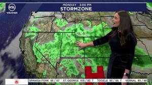
Precipitation totals have averaged between 200% and 400% or more across most of Utah, as well as many parts of Arizona, southern Nevada and southern California, Pugh wrote in an adjoining report.
"Precipitation amounts of more than 1 inch prompted a one-category improvement from Arizona north to Nevada, Utah and southeastern Idaho," he wrote, adding that it also ended short-term drought conditions for the Southwest and Great Basin, although long-term drought of "varying intensity" persists across parts of the regions.
Utah's 'uncharted territory'
Thursday's update comes days after Utah's average mountain soil moisture levels jumped to nearly 78% saturation, surpassing the median average peak during the spring snowmelt, when soils are usually most saturated.
"We're kind of in uncharted territory," said Jordan Clayton, a hydrologist for the Natural Resources Conservation Service and director of the Utah Snow Survey.
That's the result of approximately 3.4 trillion gallons of rain falling across the state over the past two weeks, KSL meteorologist Matt Johnson noted. The onslaught also caused severe flooding in parts of southern Utah and landslides across various regions.
Some reservoirs also received rare boosts. Gunlock Reservoir in Washington County, for example, surged from 37% capacity last month to over 100% this week. Two people were rescued after their vehicle got stuck in the water near the waterfalls that form as excess water is released from the reservoir.
Lake Powell has also gained 17 feet in elevation over the past month. Utah's reservoirs typically grow from snowpack runoff every spring, which is what makes the recent run so impressive.
Despite the boost, Utah's collective reservoir system remains at just 50% capacity, 10 percentage points below this time last year and 6 points below the median average, per state data.
Reservoir levels are one key element of the equation used to determine drought, U.S. Drought Monitor authors explained last month. Other impacts from this year's record-low snowpack also factor into why many parts of the state remain in drought, even with the impressive precipitation totals.
More to come?
Stronger soil moisture levels are associated with better snowpack runoff conditions in the spring.
However, Clayton said it's too early to know how the current conditions will affect conditions over the next several months because it's so much higher than anything ever documented in the fall since the Conservation Service's soil moisture network was launched 20 years ago.
Chilly and drier conditions are forecast for the state this weekend and early next week, which will likely drop percentages closer to precedented levels, but long-range models indicate that the active pattern may resume toward the middle of this month, Johnson said.
It's too early to know just how much moisture those will provide, though.