'%3e%3cpath%20d='M34.1406%205.85938C30.3906%202.10547%2025.3047%200%2020%200C14.6953%200%209.60938%202.10547%205.85938%205.85938C2.10938%209.61328%200%2014.6953%200%2020C0%2025.3047%202.10547%2030.3906%205.85938%2034.1406C9.61328%2037.8906%2014.6953%2040%2020%2040C25.3047%2040%2030.3906%2037.8945%2034.1406%2034.1406C37.8906%2030.3906%2040%2025.3047%2040%2020C40%2014.6953%2037.8945%209.60938%2034.1406%205.85938ZM37.0117%2023.543H31.1602V13.5391H27.6328V19.9414C28.1211%2020.6914%2028.3711%2021.582%2028.3711%2022.5625V22.625C28.3711%2023.668%2028.1172%2024.6055%2027.6328%2025.4297V26.6094H36.082C33.4883%2032.9375%2027.2891%2037.3789%2020.0039%2037.3789C10.3711%2037.3789%202.62109%2029.6289%202.62109%2020C2.62109%2010.3711%2010.3711%202.62109%2020%202.62109C29.6289%202.62109%2037.3789%2010.3711%2037.3789%2020C37.3789%2021.1484%2037.2617%2022.2656%2037.0508%2023.3477C37.0391%2023.4141%2037.0234%2023.4766%2037.0117%2023.543Z'%20fill='white'/%3e%3cpath%20d='M22.3086%2018.5352C20.4336%2018.125%2019.9531%2017.8398%2019.9766%2017.1836V17.1406C19.9766%2016.6992%2020.3477%2016.2148%2021.4023%2016.2148C22.582%2016.2148%2023.8867%2016.6797%2025.0781%2017.4766L26.8516%2015.0195C25.4453%2013.8906%2023.707%2013.3398%2021.5547%2013.3398C18.5195%2013.3398%2016.4375%2015%2016.4063%2017.4766V17.5352C16.3633%2020.2617%2018.5859%2020.9805%2021.293%2021.6016C23.0391%2021.9766%2023.5703%2022.3164%2023.5703%2022.9609L23.5469%2022.9766C23.5469%2023.3906%2023.2578%2023.7031%2022.7852%2023.8359C22.5742%2023.9062%2022.1289%2023.9727%2021.5156%2023.9727C20.7617%2023.9727%2019.7539%2023.8633%2018.6328%2023.4844C18.0898%2023.2891%2017.4727%2023.0039%2016.8047%2022.6133L20.1406%2026.625C20.2813%2026.6602%2021.0977%2026.8516%2021.7734%2026.8516C25.0039%2026.8516%2027.0859%2025.2461%2027.1094%2022.6328V22.5703C27.1602%2020.1133%2025.2148%2019.1719%2022.3086%2018.5352Z'%20fill='white'/%3e%3cpath%20d='M5.24219%2013.5664V26.6133H8.75391V23.7578L10.2969%2021.9531L14.2031%2026.6133H18.3867L12.3555%2019.5195L17.4023%2013.5664H13.4531L8.75391%2019.0586V13.5664H5.24219Z'%20fill='white'/%3e%3c/g%3e%3cdefs%3e%3cclipPath%20id='clip0_97_2430'%3e%3crect%20width='40'%20height='40'%20fill='white'/%3e%3c/clipPath%3e%3c/defs%3e%3c/svg%3e)




- Earth fissures in southern Utah highlight aquifer depletion issues, posing structural risks.
- Geologist Tyler Knudsen links fissures to overuse of aquifers, urging conservation efforts.
- Statewide aquifer recharge projects aim to restore balance; public awareness on water use urged.
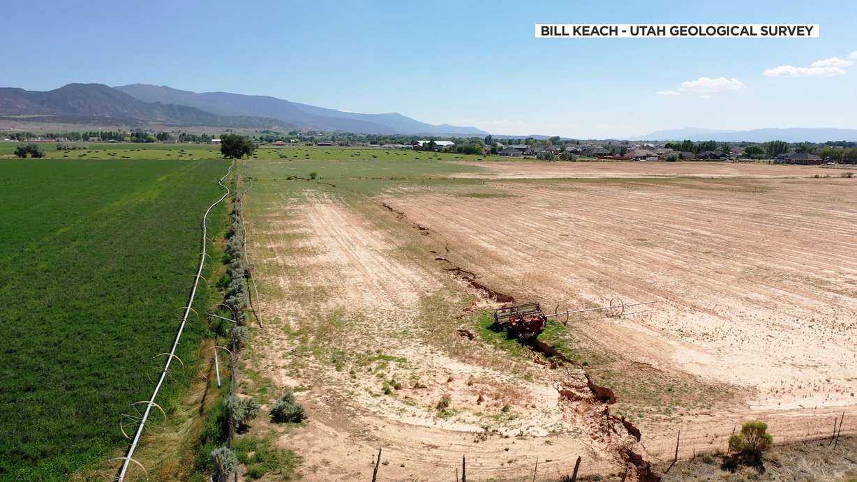
CEDAR CITY — Over the past several months, Tyler Knudsen has spent much of his time around southern Utah, studying long, deep cracks in the ground. The so-called fissures often pop up after major rain events and can sometimes span up to a couple of miles, running several feet deep.
Walking around a field in the Escalante Valley, on the west side of Iron County, the senior geologist with the Utah Geological Survey pointed out sections of a fissure.
"This is a good 10 feet deep right here," Knudsen said, pointing to a gaping hole below. "Water finds these cracks, infiltrates down into the crack and can open them up into these gullies within a matter of hours and can present a significant hazard."
The fissures can pop up with no warning, sometimes causing road damage.
"They often extend all the way down to the aquifer and even below the water table," Knudsen explained. "And they don't become apparent until those surface waters find them."
Knudsen said they're a symptom of a larger problem: the use and depletion of aquifers underground. They're naturally replenished with seasonal runoff, but we're consistently using the water supply at a rate faster than Mother Nature can keep up with.
"There's a whole suite of problems that accompany a declining groundwater table and an overtaxed aquifer," Knudsen said. "It's a problem for everybody."
Neighborhood worries
Beyond the ongoing drain on our unseen water supply, the fissures can cause a direct danger to structures built above. A concerning example runs right through a section of the Pineview Estates subdivision in Enoch. Knudsen pointed out cracks running from the road to the sidewalk, and through the driveway of one home.
"(It's) starting to undermine that corner of the garage so that home is in some structural distress," he said. "It's unmistakable. It's getting larger."
Just to the north lies an empty lot, which was supposed to be home to the Parkview subdivision. The project was canceled after a 2.4-mile-long fissure showed up, totaling the only home ever built there in 2009.
"Not only had it damaged that sewer line, it was starting to displace the road and the sidewalk, and it was obvious that things were moving fairly swiftly," Knudsen recalled. "It ran ... adjacent to brand new pavement and also through about a dozen undeveloped lots."
Those kinds of hazards are exactly why Knudsen and a team of geologists are currently updating their geologic hazards portal, which potential homeowners, water managers and policymakers can use to make better-informed decisions.
"We document these symptoms of the problem at the surface as geologists," Knudsen said. "It's going to be people that have the power to make change, that are all working together that are going to be able to bring these basins into balance."
Restoring the balance
Statewide, there are around two dozen aquifer recharge and recovery projects underway, with more pending. Some have been running for as long as a couple of decades, like one run by the Weber Basin Water Conservancy District at the mouth of Weber Canyon, where, during plentiful water years, excess runoff can be diverted into two basins that eventually seep into the aquifer below.
Darren Hess, an assistant general manager with Weber Basin Water, said the project is effective in restoring aquifers near the canyon, but said there is likely depletion taking place in areas to the west.
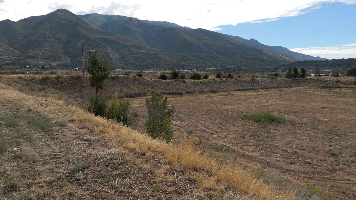
"In certain instances we've had to actually drop pumps further down into the water column to be able to get more to where the water is at," Hess explained. "So we have seen decreases of the aquifer over the years."
Hess adds that they try to find a balance in use and restoration of the water sources, adding that soil moisture is currently around 135% of normal right now, due to recent rainstorms.
"We've got 22 deep groundwater wells. We'll (use) three to five during the year. Otherwise, we're resting those wells," he said. "It's critical that we really have people understand how much water they're using on their landscapes and that they use it appropriately and properly and not overwater those landscapes, because we just don't have excess water to do that with."
Knudsen shared in those conservation concerns.
"It is a finite resource," he said. "Everybody that uses water ... needs to come together and come up with real solutions to take less water, less mining of this finite resource that we have underneath us."