

Estimated read time: 1-2 minutes
This archived news story is available only for your personal, non-commercial use. Information in the story may be outdated or superseded by additional information. Reading or replaying the story in its archived form does not constitute a republication of the story.
SALT LAKE CITY — Weather forecasters are predicting a winter storm will move into Utah on Thursday and that it will stick around through Saturday. The National Weather Service has issued a winter storm warning for the eastern side of the Wasatch Range, or, the Wasatch Back. Meteorologists with the National Weather Service in Salt Lake City expect “widespread mountain snow” as well as a “high chance for valley snow” on Thursday afternoon. However, KSL Meteorologist Matt Johnson said northern Utah valleys may see as little as one-third to one inch of snow.
STATEWIDE STORM: Our storm will move in tomorrow midday/afternoon. Starts as snow in the valleys then transitions to rain/snow mix Thursday night. Snow levels fluctuate through the event around 5-6k FEET. #utwx TIMING: FEB 13-15 VALLEYS: .33-1.00” MOUNTAINS: 12-36”+ pic.twitter.com/gCGmLIAFJc — Matthew Johnson (@KSL_Matt) February 12, 2025
Winter storm to bring most snowfall to the mountains
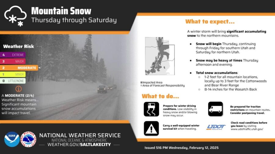
Mountain snow accumulation from this storm is expected to be higher. Johnson said that the total mountain snowfall between Thursday and Saturday could be between two and three feet between Snow Basin and Sundance ski resorts. With a “moderate” risk rating, those driving in the mountains on Thursday may be impacted the most.Drivers in northern Utah are asked to prepare for winter driving conditions, including low visibility and blowing snow. Mountain drivers should be prepared to follow traction restrictions. All drivers are urged to carry supplies in their cars in case they become stuck in the snow.