
- Heavy rainfall caused flash flooding in Hurricane, prompting evacuations.
- The National Weather Service issued a flash flood warning for southeastern Washington County.
- Flooding also closed SR-24 in Capitol Reef National Park for several hours.
HURRICANE — A local emergency has been declared in Hurricane after heavy rainfall on Thursday led to widespread flooding that has affected more than 100 residential structures in the southwest Utah city.
Hurricane Mayor Clark Fawcett ordered the declaration Thursday afternoon, hours after police advised residents in the Willow Wind complex, 80 S. 1150 West, to evacuate, along with residents along Gould Wash.
Approximately 80 residential homes and another 50 recreational vehicles at Willow Wind RV Park were impacted, based on initial assessments.
"The full extent and severity of the damage, as well as the potential displacement of residents, remain under assessment," Hurricane officials wrote in a statement.
"Flooding has also damaged or affected bridges, culverts, public roadways and electrical power boxes," the city added. "Mud and debris covering roadways, along with potential impacts to utility infrastructure, have created public safety concerns and may disrupt essential services."
City officials have yet to determine the cost of the infrastructure damage, but the declaration allows them to begin exploring state and federal resources.
Medical personnel were staged at the Coral Cliffs movie theater, 835 W. State Street, for any residents who may need medical assistance, the police department said. The Church of Jesus Christ of Latter-day Saints opened a stake center as an emergency shelter for those displaced by the flooding. It is located at 272 S. 700 West.
City officials urge residents to use caution around any flooded areas, following posted road closures, detours or instructions from emergency personnel.
"Residents should not enter flooded roadways or areas where water, mud, debris or infrastructure damage may present a hazard. Conditions may change as response and assessment operations continue," they added in the statement.
Hurricane officials said they had been monitoring the forecast and conditions and sent a notification to residents in the floodplain about impending extreme weather.
The National Weather Service eventually issued a flash flood warning for southeastern Washington County, including Hurricane, shortly before 10 a.m. The agency warned that between 1 and 2 inches of rain had fallen across the headwaters of Gould Wash, creating a "large flood wave" that was "moving downstream through Hurricane."
The flooding prompted evacuations. Videos sent to KSL by residents show water cascading down several streets in Hurricane, with water up to the grills of cars and trucks in some locations.
Flood warning issued along Colorado River Basin
Flooding elsewhere in the state also closed a section of state Route 24 in Capitol Reef National Park. The highway is closed from mileposts 81 to 86 because of flooding debris, the Wayne County Sheriff's Office said. It may remain in place for "several hours."
Federal forecasters previously issued a flood watch for most of southern and central Utah over flooding potential from a system passing through Utah this week.
Other periodic flood warnings have been issued in other parts of both regions over the past couple of days, including ones at Zion National Park and the Pine Valley area of Washington County earlier on Thursday.
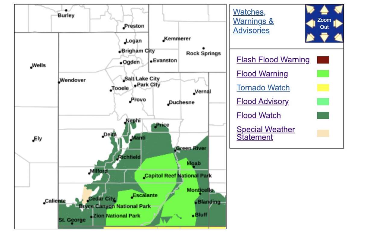
However, the weather service issued a rare, expansive flood warning across many parts of southeast and south-central Utah, which appears to cover areas east and west of the Colorado River south of Moab.
"Flooding of normally dry washes, slot canyons, rivers, creeks and other low-lying and flood-prone locations is occurring," the warning states, explaining that heavy rainfall and near-saturated soils will "allow flows to remain high across all waterways within the warned area," which includes all of the Glen Canyon National Recreation Area and Lake Powell.
Areas near the Paria River, Wahweep Creek, Warm Creek, Last Chance Creek, Croton Canyon and the Escalante River Basin and their tributaries are also included in the warning, which lasts through 12:15 p.m. on Friday.
Many backcountry roads within the warning area are "expected to become impassable," the agency added.
The system already dumped more than 2 inches of rain in the Monument Valley and Monticello areas on Wednesday, said KSL meteorologist Matt Johnson. Many other parts of southern Utah already received more than an inch of rain.
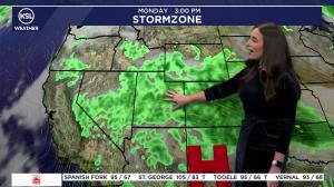
While the low-pressure system was originally expected to split up, impacting southern and central Utah before hitting northern Utah, scattered showers and thunderstorms are now forecast across the state on Thursday.
They're projected to target central and southern Utah the most in the morning and afternoon, while the chances of storms impacting the Wasatch Front and northern Utah will increase in the afternoon and evening, Johnson said.
Some storms are expected to linger into Friday morning, especially across northern Utah. Additional spotty showers are possible throughout the rest of Friday as the system clears out.
Drier and cooler weather is forecast for the weekend.
Contributing: Joe Wirthlin
This story will be updated. To be notified about updates, please click Follow This Story below on the KSL app.