Estimated read time: 4-5 minutes
This archived news story is available only for your personal, non-commercial use. Information in the story may be outdated or superseded by additional information. Reading or replaying the story in its archived form does not constitute a republication of the story.
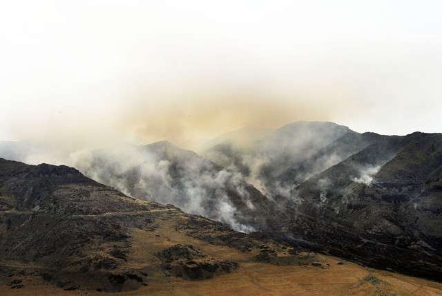
SALT LAKE CITY — As clouds rolled over the state Friday — bringing with them the promise of rain — crews in different parts of the state battled two large fires.
Those just southeast of Hurricane in southern Utah were able to rein in a blaze they had battled since Tuesday, reaching 100 percent containment on a fire that had swelled to 2,200 acres. In northern Utah, as many as 50 fire personnel in Box Elder County settled in for their second day battling the Long Canyon Fire.
That blaze was ignited by lightning Thursday morning and grew to close to 4,000 acres as of Friday afternoon, according to Jason Curry of Utah's Division of Forestry, Fire and State Lands. Firefighters were able to achieve 20 percent containment and had to work to preserve a few ranch homes in the fire's path.
"It's scary when we look around us at other states and know we are not immune to that, we could have the same event and it's devastating," Curry said. "But often times, firefighters are out there putting their lives on the line and keeping us safe."
Curry said the fire did not pose an imminent threat to the public and no injuries have been reported.
An early fire season
The fire started early in the year, Curry said, as June 1 normally signals the arrival of the fire season. But this year, fires have been aided by the dry fuel conditions caused by a winter light on snow that led to an abnormally dry spring. Coupled with the higher, warmer temperatures that come with summer, it is expected fire activity will grow.
We can't control the conditions in terms of Mother Nature, but we can have control over fires caused by humans. If people are more careful out there, we're hoping it can have an impact on some of this dryness.
–Jason Curry, Division of Forestry, Fire and State Lands
"We are concerned about it," Curry said. "We expect to get some fires. We can't control the conditions in terms of Mother Nature, but we can have control over fires caused by humans. If people are more careful out there, we're hoping it can have an impact on some of this dryness."
David Eaker, a National Park Service spokesman who specializes in fire information and education, said the Hurricane fire was human-caused. He asked that people be careful with campfires, barbecues, cigarettes and even driving their vehicles in tall grasses.
"It's very dry pretty much across Utah and the West," Eaker said. "We just hope the public is going to be careful out there."
Fire season sometimes starts as early in April in southern Utah, so Eaker said he wasn't surprised by the activity that he's seen thus far. The Hurricane fire, though fully contained, may continue to put off smoke "as some of the heavier fuels burn out."
The weather's role
Forecasted rain Memorial Day weekend could be a welcome relief, but Curry said it's still unclear what the storms — and the wind that carries them in — will mean for the Long Canyon Fire. The presence of rain doesn't mean the blaze will be extinguished.
"It won't be over today and it probably won't be over tomorrow," Curry said of the fire. "Beyond that, it's too early to tell. We do have strong winds that may throw us a curve ball and make it grow. We are trying to limit that and keep the fire under control.

We don't know if this incoming storm is going to be more harm or more help."
KSL's chief meteorologist Kevin Eubank said this holiday weekend will be similar to last year — wet and windy. Some parts of the state may even see snow and temperatures in the 30-degree range.
"This Memorial Day may be a washout like last year," Eubank said. "There's a series of storms coming in."
According to the KSL Weather Center, rain and cooler temperatures are predicted for both Logan and the Wasatch Front.
In Logan, Saturday is projected to bring rain and a high temperature of 64 degrees, with a low of 42 degrees. Sunday in Logan is anticipated to be partly cloudy, with a high of 64 degrees and a low of 37 degrees. Monday should warm up with sunny skies and a high temperature of 72 degrees, a low of 38 degrees.
St. George should expect a Saturday high of 75 degrees and a low of 55 degrees. Sun is predicted for Sunday with a temperature forecast of 78 degrees and low of 54 degrees and the fine weather is expected to carry into Monday with a high of 88 degrees and a low of 58 degrees.
Contributing: Sam Penrod and Benjamin Wood


