Estimated read time: 2-3 minutes
This archived news story is available only for your personal, non-commercial use. Information in the story may be outdated or superseded by additional information. Reading or replaying the story in its archived form does not constitute a republication of the story.
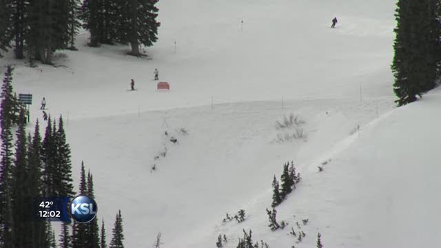
SALT LAKE CITY -- The Utah Avalanche Center has issued an avalanche warning as a storm heads for parts of northern and central Utah.
We may not have the snow we are used to in the mountains right now, but there is still enough there that when this new snow is dumped on it - the risk of a deadly avalanche is high.
The warning takes effect Wednesday at 2 p.m. and extends into Thursday for the mountains of northern and central Utah, including the Western Uintas.

In a news release, the center said, "Heavy snow and strong winds will increase the avalanche danger to HIGH late this afternoon or tonight. Large natural and human triggered avalanches are likely during the overnight hours Wednesday and on Thursday."
At the UAC, forecasters say the snow expected over the next few days will overload an already lose and weak snow- pack. "It's going to be like putting a frying pan on top of potato chips," said Evelyn Lees with the UAC.
Just yesterday, a member of the UAC caught video of just how weak the snowpack is in the Western Uinta's. The forecaster triggered an avalanche that was 3 feet deep and 125 feet wide.
"It would have been very serious if anyone had been in it," Lee said, "but they triggered it from a very safe place. But that's indicative of what we'll be dealing with when we get more snow."
Utah Avalanche Center website: www.utahavalanchecenter.org
Avalanche Control work message feeds via twitter: @UDOTavy; @UACwasatch; @CanyonAlerts
Unified Police Department in Greater Salt Lake website: www.updsl.org: Refer to Canyon Alerts on right margin on homepage for information and options
Unified Police Department in Greater Salt Lake SMS Text: From cell phone text "canyonalerts" to 53535 for critical open/close updates
Unified Police Department in Greater Salt Lake email updates: Send a blank email to subscribe@CanyonAlerts.org
Signage along roadways at certain trailheads indicating backcountry access
Forecasters warn winter enthusiasts to stay out of the back country in closed areas; if you ignore that warning you will get a ticket.
"To enter one of these closed areas is a class B misdemeanor," said Alta Town Marshall Mike Morey.
They also warn those hitting the roads this afternoon to slow down and be cautious. Little Cottonwood Canyon is one of the highest risk roads for avalanches in North America. And along the surface streets, the transition from snow to rain could catch drivers off guard.
"We'll have commuter issues this afternoon, in the north maybe as far as Salt Lake City and it could continue into Thursday morning along the northern Wasatch front," said Michael Conger Lead Forecaster for the Utah Weather Service.
The warning doesn't apply to ski areas where crews conduct avalanche control.
A storm is expected to arrive in the late afternoon or early evening hours with snow at some point turning to rain in the valleys. By Thursday morning, as much as 10 to 16 inches of snow could be delivered to the mountains.
Get the latest forecast here.
----
Written with contributions from The Associated Press.