Estimated read time: 3-4 minutes
This archived news story is available only for your personal, non-commercial use. Information in the story may be outdated or superseded by additional information. Reading or replaying the story in its archived form does not constitute a republication of the story.
SALT LAKE CITY — Most of Utah will be covered in snow for the second straight weekend starting Saturday evening.
Valleys along the Wasatch Front can expect 4-8 inches through Sunday morning, KSL TV meteorologist Kevin Eubank said.
“Everyone on Saturday from Logan to Cedar City is going to get snow,” Eubank said.
Benches along the Wasatch Front can expect 7-14 inches of snow, he added.
The mountains in northern Utah could see 1-2 feet of snow, while the southern Utah mountains should get 6-12 inches, he said.
The storm system moving into Utah over the weekend is cold and wet, Eubank said. It has already produced 3-5 inches of rain in northern California.
There is nothing blocking the storm, and it is on track to move in a straight path to Utah, Eubank said.
The snowfall will start north of Salt Lake City on Saturday evening. The storm system will stall over the Wasatch Front, and how much snowfall areas in Utah will get depends on where exactly the storm stops.
If it stalls over the Salt Lake Valley, the city will see lots of snow, Eubank said. If it stalls further north over Ogden, Salt Lake City won’t get as much snow, but will see high winds throughout the weekend.
“It’s a big storm and it’s complex,” Eubank said.
The system will linger in the area on Sunday morning but will dissipate by Sunday afternoon. Sunny skies are expected on Monday, Eubank said.
Most of the state will be under a winter storm warning starting Friday and continuing until 11 a.m. Sunday, according to the National Weather Service.
That warning will start at 9 a.m. Friday for west and northern Utah, including the West Desert, Wendover, Ogden and Logan. The winter storm warning also will start at 9 a.m. Friday for the Wasatch Mountains and for the northern I-80 corridor.
The storm warning for the Salt Lake and Tooele valleys starts at 4 p.m. Friday.
Before the storm, much of the state will see strong winds starting late Thursday into early Friday. Areas along the Wasatch Front, the West Desert and the southern Utah I-15 corridor will be under a wind advisory from 3 a.m. to 8 p.m. Friday, according to the National Weather Service.
KSL TV meteorologist Grant Weyman said early Friday morning there were wind gusts reaching 60 miles per hour. The wind knocked out power in Tooele, causing an outage for roughly 3,000 people as of 7 a.m.
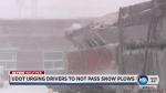
Travelers should expect winter driving conditions, snow-covered roads and limited visibility throughout the weekend, according to the National Weather Service.
Though the storm could be cumbersome for Utahns, the snowfall is much-needed, Eubank said.
The precipitation will mean more water is available in the long term. In the short term, the storm has the potential to put 100 inches of snow on the ground at Utah ski resorts for the first time this season, Eubank said.
“We need these storms,” he said. “These are good storms. … While it’s inconvenient, it’s a good scenario for us.”
Visit the KSL Weather Center for the latest updates, and keep an eye on KSL's weather alerts page for up-to-date information.
Editor's note: This story has been updated to reflect changes in the forecast.


