Estimated read time: 1-2 minutes
This archived news story is available only for your personal, non-commercial use. Information in the story may be outdated or superseded by additional information. Reading or replaying the story in its archived form does not constitute a republication of the story.
East Hollywood Charter High School in West Valley City reports a late start, at 10:35 a.m.
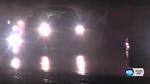
SALT LAKE CITY (AP) — With the first major storm of the season expected to move through Utah Monday, crews from the Utah Department of Transportation have been out on the roads preparing for the impending commute.
Curious how much snow to expect across Utah Mon thru Tues evening? Check out the graphic for totals #utwx#utsnowpic.twitter.com/EPW1Zw0T2H
— NWS Salt Lake City (@NWSSaltLakeCity) December 13, 2015UDOT said their trucks would be out as soon as the snow begins coming down. The agency encouraged Utah drivers to be prepared, too.
Winter storm warnings and winter weather advisories now in effect for much of Utah. Check here for more info: https://t.co/cBXee6CtxY#utwx
— NWS Salt Lake City (@NWSSaltLakeCity) December 13, 2015UDOT said the most significant driving habit that contributes to accidents on snowy roads is drivers who are going too fast for the conditions. Their recommendation is to take your time, and arrive alive.
Winter driving tips:
*SLOW DOWN
*Increase following distance
*Buckle up
*More info here: https://t.co/XdUi1dFUaipic.twitter.com/c3aSW2EgqQ
— Utah Highway Patrol (@UTHighwayPatrol) December 14, 2015The national weather service is reporting as much as a 50 percent chance that a foot of snow ends up in the valleys along the Wasatch Front on Monday.
KSL will be closely monitoring school closings late Sunday and early Monday mornings and will report accordingly.
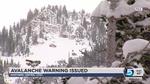
Authorities have also issued an avalanche watch in the mountains of northern and central Utah. The U.S. Forest Service Utah Avalanche Center said Sunday that dangerous avalanche conditions were expected to begin Monday and last through the week in southeast Idaho, the Bear River Range, the Western Uintas and the Wasatch Plateau.
An AVALANCHE WATCH is in effect. Moderate danger today but expected to rise with the approaching storm. #utavypic.twitter.com/7l5gToJ5qA
— UtahAvalancheCenter (@UACwasatch) December 13, 2015The danger will be greatest on mid- and upper-elevation slopes facing west and north.
The advisory didn't apply to ski areas where avalanche control is normally conducted.
We want you to send in your photos and videos of the storm to KSL.com. To submit, you can click the "Submit to iWitness" button below, visit the iWitness section on KSL.com or use the KSL.com app via an Android or iOS device.


