Estimated read time: 3-4 minutes
This archived news story is available only for your personal, non-commercial use. Information in the story may be outdated or superseded by additional information. Reading or replaying the story in its archived form does not constitute a republication of the story.
SALT LAKE CITY — The water situation for Utah looked dismal last month, but storms over the past week have made a huge difference for all who live in northern Utah.
"These kinds of storms are just amazing in the amount of water that they put into the snowpack," said hydrologist Randy Julander, a snow survey supervisor with the National Resources Conservation Service.
The water in Utah's winter snowpack is the water the state needs to fill its reservoirs for the rest of the year, and the following years. After a very dry January, northern Utah is getting a good, long drink.
Julander said, researchers have to go back to 2011 and 2005 to find a series of storms that made this big a difference for Utah's water supply. This year is even more impressive, he said, because the wet weather follows and extended dry period that lasted several weeks.
"To one go from extremely dry, and then, get this kind of the storm that's a game changer. I can't remember the last time we had one of these," he said.
These storms are not drought-busters by any means, and southern Utah missed out, but the hydrologist pointed out they're exactly what most of the state's communities need.
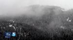
Near Parley's Summit Wednesday rain turned to snow, as another wave of moisture moved in to northern Utah. In the week ahead, KSL meteorologists forecast a few more likely storms.
A week ago, the weather pattern changed dramatically, opening the door for wet storms. Snowpack in northern Utah basins has risen 15 percent to 25 percent. This current storm will put much of northern Utah over 100 percent, which is average. A couple of mountain weather stations recorded more than four feet of snow, containing as much as seven inches of water over the past week.
"That puts us from the fire back into the frying pan," said Julander. "It doesn't solve our drought problem, but it gives us a lot of breathing room up here in northern Utah."
See Utah's snowpack totals for specific areas here.
Statewide, Utah's reservoirs are at about 50 percent and below, with some in the 30 percent range in northern Utah. Julander said it would be ideal if the snow keeps piling up through April 1. The snowpack needs to be above average before the run-off in order to start refilling the reservoirs.
"That's our ace in the hole, money in the bank," Julander said of the reservoirs. "When that's down, you really count on lots more coming in."
Southern Utah is still dry with snowpack in the 60 percent to 90 percent range. A month ago, the USDA designated 12 Utah counties as a primary disaster area because of long-term drought conditions.
So, these storms help, but..,
"Certainly not a drought-buster, and we still have a month and a half left in the traditional snow accumulation season. Anything can happen," Julander said.
All of this rain has also caused flooding problems for communities in Cache County and Summit County. There's always a fine line when it comes to the maximum benefit of all of this precipitation. For most of the state's communities, they need it to keep coming.
"We're crossing our fingers, and are hoping the storms keep coming through," Julander said.