Estimated read time: 2-3 minutes
This archived news story is available only for your personal, non-commercial use. Information in the story may be outdated or superseded by additional information. Reading or replaying the story in its archived form does not constitute a republication of the story.
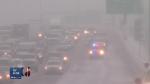
SALT LAKE CITY — Snow may currently blanket nearly the entire state, but conservationists said Tuesday it's essentially "meaningless" to state snowpacks.
"Particularly in the southern part of the state — that will all melt off," said Natural Resources Conservation Service snow survey supervisor Randy Julander. "Up here in the north, it'll melt off a little bit here and there."
Meanwhile, mountain snowpacks in the Uintas and northern Wasatch mountains are actually lower than they were at this time a year ago.
Northern Utah's snowpacks — even after the recent strong storms — are roughly at 80 percent of average, Julander said. The snowpacks need to reach 120 percent of average to fill the reservoirs and be at a place the state "would like to be."
"Right now, reservoir storage is at 50 percent of capacity," Julander said. "We are way, way down."
Conversely, southern Utah's mountains have benefitted from the recent storms, boasting snowpacks from 100 percent to 250 percent of average.
However, the widespread ground snow does set up the potential for a strong inversion — where a warm layer of air traps a cold layer of air below along with fog and pollutants, according to meteorologists.
"We're setting up the misery index pretty fast," Julander said.
Neither Julander nor KSL meteorologist Grant Weyman could definitively forecast a protracted inversion season, but both suggested the early factors are there — with very cold air in the valleys, plenty of snow on the ground and days only growing shorter for now.
"If we've got cold air early and we've got snow on the ground, yeah, we could see it lasting longer," Weyman said.
Conditions were expected Tuesday to potentially develop into a more defined inversion situation by late in the week.
"What we need to have happen if we don't want to see a lot of inversions this year is have storm after storm — clean things out, keep things from building up," Weyman said.
Whether or not the early season snow and cold has been worse than last year, Salt Lake City resident Ron Schulthies said he believed it was more extreme.
"Oh, it's a shock here," he said. "It's so cold early."
Another resident, Bonnie Weiss, said she hoped the winter would bring more snow and would ultimately make a difference with the water picture.
"Fingers are crossed, toes as well," she said. "Mostly because they're cold."