Estimated read time: 3-4 minutes
This archived news story is available only for your personal, non-commercial use. Information in the story may be outdated or superseded by additional information. Reading or replaying the story in its archived form does not constitute a republication of the story.
SALT LAKE CITY — Northern Utah tree rings going back to the time of Christopher Columbus should have water managers across the state on alert for droughts even more extreme than what modern history has delivered.
That finding comes with new research, the first of its kind, that came out of a BYU study revealing "nightmare" droughts in the West. The study represents the first time a tree-ring reconstruction has been done for a major river feeding the rapidly growing Wasatch Front.
In the research, scientists tracked Utah's climate record back to 1429 and found that the most severe drought in that period began in 1492 — and the five worst droughts happened during the explorer's lifetime.
"I think that this is a clear message not only from this reconstruction (in Utah) but throughout the West that we should be prepared for more severe droughts in the future," said BYU geography professor Matthew Bekker. "It would be a good idea to think ahead of it so we are not surprised by it."

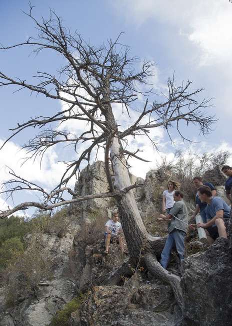
Bekker and fellow researchers from the U.S. Forest Service, Utah State University and Columbia University used tree rings from both live and dead trees to chart climate patterns over five centuries, a span that showed extreme fluctuations between the real wet years and the real dry years.
The study, published in the Journal of the American Water Resources Association, correlates modern stream flow measurements to the thickness of the tree rings and drought severity.
Core samples from Douglas fir and pinyon pine were used because of their particular sensitivity to drought, with the study mapping the hydrology of the Weber River, one of the most important sources of water for the Wasatch Front.
Research found:
• The year 1703 kicked off 16 consecutive years of below average stream flow.
• The Weber River flowed at just 13 percent of normal in 1580 and dropped below 20 percent in three other periods.
• The most severe drought in the record began in 1492.
Bekker said the study has important implications for Utah because of its status as the second-driest state in the nation and its No. 3 spot in the country for population growth — which jumped 23.8 percent from 2000 to 2010.
"If you think about day-to-day water management and our growing population, if we were to have one of those really intense droughts or long duration droughts again, then we would have challenges with our water management," Bekker said. "Bigger challenges than what we have seen."
Uncertainty is a hallmark of this region's hydroclimate, and climate change will only increase that uncertainty.
–study published in the Journal of the American Water Resources Association
Bekker is circulating the study's findings with water managers, particularly in northern Utah.
"Uncertainty is a hallmark of this region’s hydroclimate, and climate change will only increase that uncertainty," the study concluded.
The findings demonstrated in five centuries of tree rings, Bekker emphasized, point to an "overly optimistic instrument" record of drought and wet periods for the region.
"As we have been dividing up all the water that we have in the West and building reservoirs and making plans for future population growth, we've been basing that on relatively higher flow," he said.
"What they can do now is take those data and say, 'OK, we need to plan for a little bit more worst-case scenario than what we have planned for now."
Ultimately the research team hopes to dissect an even more comprehensive record of climate patterns, charting hydrologic history back to the eighth century — or the time when Vikings were beginning their conquests of northern Europe.
Contributing: John Hollenhorst


